During my first two tours in Vietnam, I lived either on or very close to a major canal or river. When I served at the district capital at Ấp Bắc in 1969 to 1970 we lived along the ”Grand Canal” or more specifically the “La Grange–Ong Long” canal route and the important cross roads of the Kênh Moi Hai (Canal Number-12). The Kênh Moi Hai ran north to south to southeast through Kiến Tường province, crossing the La Grange canal at Ấp Bắc and continuing toward the Mỹ Phước Tây – Cai Lậy area.

Bridge over the Grand Canal at Ấp Bắc – Kênh Moi Hai (Canal Number-12) heading towards Moc Hoa

The Grand Canal, which ran directly in front of our team house was a vital waterborne transportation corridor through the Plain of Reeds stretching from the Vàm Cỏ Tây River along the III-IV Corps border all the way to the Bassac River and the major city of Cần Thơ.

The Grand Canal
During the Vietnam War, the Mekong Delta’s canals were simultaneously civilian lifelines, military transport routes, and contested supply corridors. I’d put their importance this way: controlling the waterways meant influencing who could move, trade, obtain food, and reach isolated communities—not simply who held a particular stretch of land. The delta’s limited road network and seasonal flooding made boats essential. Civilians transported rice, fish, and other goods through the same waterways used by military forces. Việt Cộng and North Vietnamese forces relied on rivers and canals to move personnel and supplies between local bases and routes connecting with Cambodia. This made waterway control central to the conflict in a region that produced most of South Vietnam’s rice.
One of the big advantages when we were living at the district capital of Ấp Bắc was the fish boat. The fish boat was an interesting looking barge that would come up to our village at least once a week. I have no idea how they had constructed it, but the bottom of the boat was a large open fish-well. It was divided into little cages, and we could get fresh fish from the ocean from the barge. The fish were still alive in the well and we could go down and actually pick out the one that we wanted. Now we ate a lot of fish that came out of the canal, most of them were what we would call carp in the United states, but we refer to them as “shit fish”. They were basically bottom feeders, and they had an unusual taste of them. But when the fish barge came to town we got some fantastic seafood. One of my favorite was swordfish. He would normally have one or two swordfish that he saved just for us. Now these weren’t large fish they were probably 3 to 5 feet long in the bottom of the boat, but they were fresh. Our maid would have the boat master kill them on the spot and then she’d bring the fish into the team house and fix it for the entire family. But we could also get large prawns and if you haven’t had a prawn think of them as a very-very large shrimp, just a bit smaller than a lobster.
The water in the canals was extremely polluted. The Vietnamese would build their privies right over the canal and all the human waste went right into the water. You might find a row of privies along the canal and a few 100 feet upstream from where you would see people bathing in the water. Needless to say, we had a lot of parasitic diseases that spread throughout the villages. The same water would also be used to flood the rice paddies.
The Vietnamese used a large, almost canoe shaped, boat called a sampan. Some of these were made for individual use getting around a village or getting to and from markets. Others were larger that were used for commerce. And some were even used as water taxis. Most were propelled with a motor that had a very long drive shaft attached to it and propeller at the end. This allow them to navigate in and around many of the smaller canals because they could raise their propeller, so they were just barely underwater. It also allowed them to turn quickly.

Vietnamese women in sampan
The biggest problem that we had with our big Kenner ski barge was the wake that we would create when we drove down the canals. The ski-barge had two 40 hp engines, and we had to be very careful in passing sampans, especially some of the smaller ones, so as not to swamp them with our wake. But in some areas the canals were wide enough that we could make a large semicircular pattern around the sampan and all it would do was to gently raise the boat in the water as a result of our wake.

Sampan along one of the smaller canals – harvesting tram wood

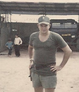
SFC Hartwig at Con of Kenner Ski-barge
You see these two major canals were not the only canals in our area. There were hundreds of smaller canals that had been dug to drain the area for rice production. The smaller canals, some of them only a few feet wide, could also be used to move men and materiel throughout the Mekong delta. These smaller canals were often the ones that we dealt with the most. The rivers and the Grand Canal as well as the Kênh Moi Hai were patrolled by the Navy patrol boats, PBRs. But the smaller canals were too narrow, in most cases for the large boats to get through. However, my smaller boat could easily navigate most of these smaller canals. We would often load 8 Vietnamese soldiers myself and my Sergeant and run operations up these smaller drainage ditches/canals. This is where we often ran into Việt Cộng soldiers trying to infiltrate into South Vietnam. We would interdict sampans that were carrying supplies to the Việt Cộng and NVA in our area.

Smaller boat we used in the small canals – Boston Whaler
In some cases, these inland canal operations were capable of supporting limited operations by the US and Vietnamese navy; the connected waterways of the Plain of Reeds and Vàm Cỏ system were important too.
American and South Vietnamese river forces used the network for three related but distinct purposes:
- River patrol: Operation Giant Slingshot, sought to restrict Việt Cộng use of inland waterways in our area. The US Navy, and later the South Vietnamese naval forces used small Patrol Boats River to patrol these waterways. PBRs became its most recognizable craft along the rivers and the major canals.
- Transporting and supporting ground troops: The Mobile Riverine Force combined U.S. Army troops with Navy vessels, including armored troop carriers and support craft. Waterways allowed these forces to reach areas where road movement was difficult.
- Operations during the monsoon season when the roads were flooded or otherwise impassable
A greater focus on canals happened during my initial tour in 1969-1970. Our operations increasingly focused on disrupting supply routes from Cambodia and reaching bases deeper in the delta. The canal network thus became a more prominent part of the effort to restrict movement through the delta.

Military use did not replace the canals’ everyday functions. Farmers, traders, and families still depended on them. Boat inspections, restrictions on movement, and fighting could consequently affect commerce and access to communities. Securing a navigation route was also different from establishing lasting control over the settlements along its banks.

Vietnamese ‘hooch’ along the Grand Canal – note: personal ‘dock’ off canal
As American forces withdrew, boats, bases, and responsibilities were progressively transferred to the South Vietnamese Navy. The Tuyên Nhơn base was transferred in April 1971 shortly prior to my departure from Mộc Hóa. This was significant to me because I had also served as the intelligence officer for Tuyên Nhơn district during the drawdown of US forces. Since Ấp Bắc was only about 15 kilometers away I was assigned to work with both districts due to personnel shortages prior to my assignment as the Province Senior Intelligence Advisor at Mộc Hóa.

US Navy PBRs Preparing for turnover to Vietnamese Navy
In short: canals originally developed for farming and trade became part of the war’s transportation and supply infrastructure. Their significance lay in the connections they provided between border areas, military bases, agricultural production, and civilian settlements.
The Mekong Delta’s canal system is both a transportation network and a vast water-management system. It connects rivers, farms, villages, markets, and ports—and much of the landscape people think of as the delta was shaped by canal digging rather than by nature alone.
The Vietnamese delta’s principal Mekong branches are the Tiền River and the Hậu River, also known as the Bassac. Artificial canals connect these waterways with smaller streams, inland wetlands, and routes toward the coast. They range from broad commercial waterways to narrow agricultural channels.
The important distinction is that this is not one unified canal built at a single time. It is an interconnected landscape developed over generations, with different channels serving navigation, drainage, irrigation, or several purposes at once.
Canal building in the Mekong delta predates French rule. Major canal projects were already underway under the Nguyễn dynasty in the early nineteenth century. The French subsequently expanded the network, especially from approximately 1880 to 1930, using mechanical dredging to open transportation routes and drain land for cultivation. These projects helped turn the delta into a major rice-exporting region, although their benefits were accompanied by unequal land ownership and social conflict as well as a significant loss of biodiversity.
The canals do much more than carry boats they bring freshwater to fields, remove excess floodwater, and help farmers manage difficult soils. In places such as the Plain of Reeds, drainage is complicated by acid sulfate soils. When certain waterlogged soils are exposed to air, they can produce sulfuric acid. Consequently, simply draining a wetland does not necessarily make it good farmland: water levels and freshwater flushing must be managed carefully.
Another distinctive feature is tidal influence. Water movement depends on river discharge, tides, seasonal flooding, and connections between channels—not merely on a permanent “downstream” direction. During periods of low freshwater flow during the dry season, saltwater can penetrate inland through the waterways. We could see as much as a six to nine foot tidal flow during the peak of the dry season.
Houses, markets, and other commercial activity developed along the canal banks and at intersections, so the waterways helped determine where communities grew. The network also had strategic significance during the twentieth-century wars, when water routes and control of water infrastructure became intertwined with the conflict.

The key takeaway: the canals are not just waterways passing through the Mekong Delta; they helped create its agricultural landscape and settlement pattern.
If you’re enjoying these blogs, please drop me a comment or if you have any questions that I might answer, submit a comment on the comment pages. I’m always glad to hear from you.
Again, please look at all my books that I have listed. They can be reviewed and/or purchased from Amazon.com with the click of a button directly from my website: http://www.ptaylorvietnamadvisor.com, at Authors Published Works.
The Advisor Series:
- “The Senior Army Instructor; The Paul Tyler Saga Begins” (https://www.amazon.com/dp/BOGSXJ2ZHC)
- “The Advisor, Kien Bing, South Vietnam, 1969-1970. A Novel” (https://www.amazon.com/dp/B09L4X5NQ3)
- “The Province Senior Intelligence Advisor, Kien Song Province 1970-1971; A Novel” (https://www.amazon.com/dp/B0BHL2XCX5)
- “The Hardchargers,” Vietnam 1972-1973; A Novel” (https://www.amazon.com/dp/B0C7SPR1JY)
- “The Tuscarora Trail” (https://www.amazon.com/dp/B0D3QY2GM6)
Civil War History/Fiction:
- “A Civil War History of Harrison County West Virginia 1861-1865” (https://www.amazon.com/dp/ B0B1CLL28Q
- “The Most Hated Man in Clarksburg” (https://www.amazon.com/dp/ B0C6429M1X
Science Fiction: (Chuck Neighbors author, Taylor *editor/**co-author)
- *“Destiny” https://www.amazon.com/dp/B0B6WGWHLS
- *“HomeFall” https://www.amazon.com/dp/B0CJN1JLWF
- **“The Planet’s Revenge; The Katy Sterling Saga Continues” https://www.amazon.com/dp/B0CYQBHC6C
Return to Author’s Published Works
Leave a Reply